GMDSS: Secure Communication for Maritime Emergencies

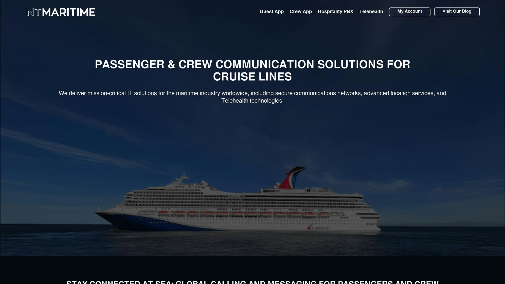
The Global Maritime Distress and Safety System (GMDSS) is a critical communication network designed to ensure safety and coordination during maritime emergencies. It connects vessels with shore-based Rescue Coordination Centers (RCCs) using satellite and radio technologies to send automated distress alerts and safety information. Mandated by the International Maritime Organization (IMO), GMDSS applies to passenger ships and cargo vessels over 300 gross tons on international voyages.

Key Features of GMDSS:

  • Automated Distress Alerts: Sends a ship’s location and identification instantly.
  • Redundancy: Requires at least two independent methods of distress communication.
  • Safety Information: Provides weather updates, navigational warnings, and search-and-rescue coordination.
  • Equipment Requirements: Includes Digital Selective Calling (DSC), EPIRBs, NAVTEX, SARTs, and backup power systems.
  • Sea Area Coverage: Divides the oceans into four zones (A1–A4) with tailored equipment needs.

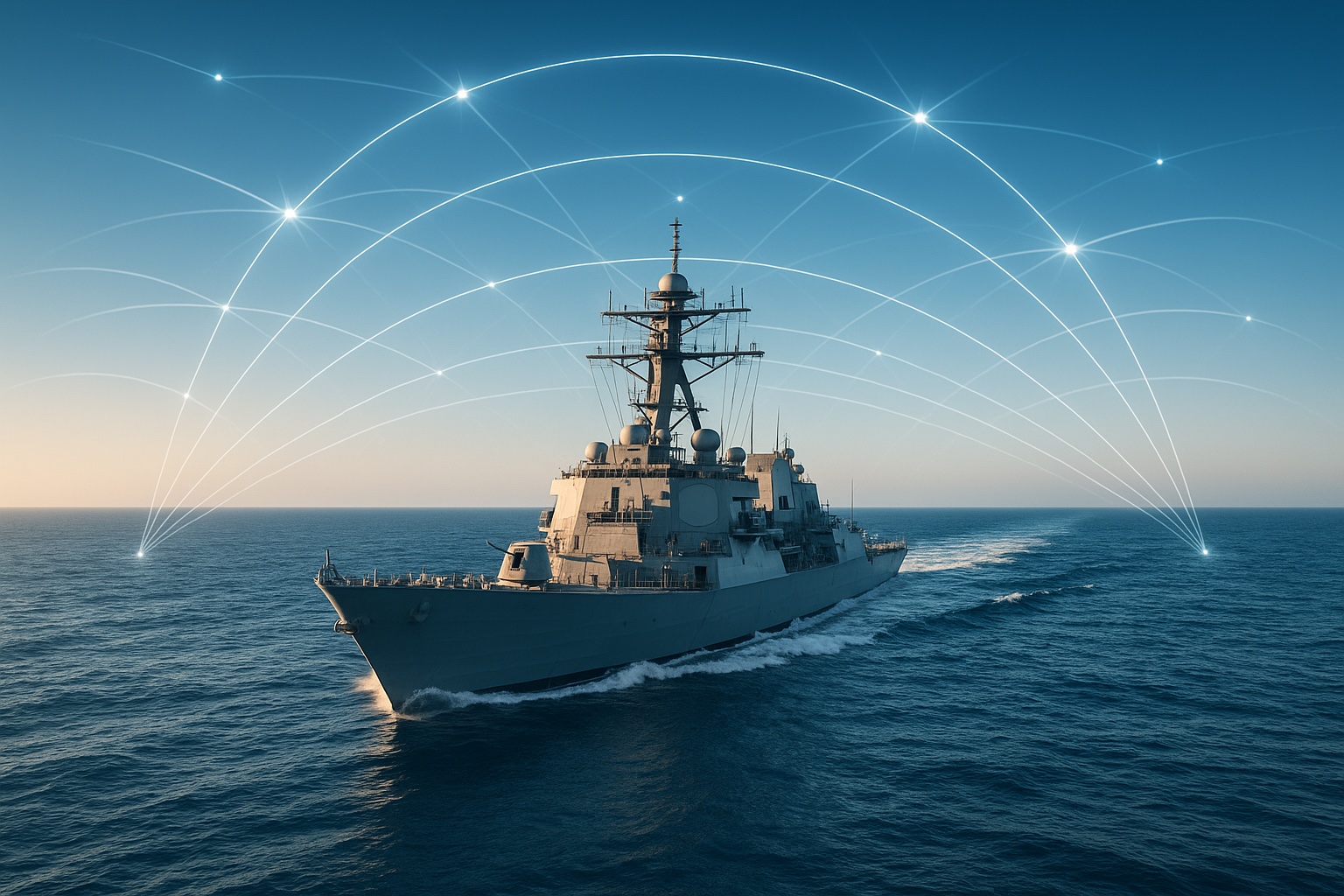
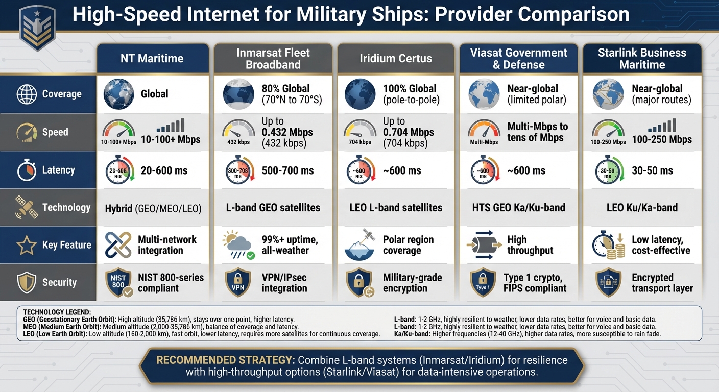
Recent updates (effective January 1, 2024) introduced modern satellite services like Iridium, ensuring global coverage, including polar regions. Companies like NT Maritime support GMDSS with advanced IT solutions, offering encrypted communication, high-speed internet, and real-time system monitoring for safer maritime operations.

GMDSS remains a cornerstone of maritime safety, enabling fast, reliable, and secure communication during emergencies.

What is GMDSS (Global Maritime Distress and Safety System)

GMDSS Functions and Components

GMDSS Sea Areas and Required Equipment by Maritime Zone

GMDSS Sea Areas and Required Equipment by Maritime Zone

Primary Goals of GMDSS

The Global Maritime Distress and Safety System (GMDSS) was designed to handle nine key communication tasks that all equipped vessels must perform. These include sending and receiving distress alerts (both ship-to-shore and ship-to-ship), coordinating search and rescue (SAR) efforts, facilitating on-scene communications, transmitting locating signals, sharing maritime safety information (MSI), and enabling general and bridge-to-bridge communications.

One of the major shifts introduced by GMDSS was moving distress alerting from a ship-to-ship system to a direct connection with shore-based Rescue Coordination Centers (RCCs). These centers are responsible for managing and coordinating rescue operations.

"The GMDSS became inextricably linked with the parallel implementation of the International Search and Rescue Convention (SAR Convention) and the development of shore facilities within the structure of the World‐Wide SAR Plan."

  • International Mobile Satellite Organization (IMSO)

In addition to distress alerts, GMDSS provides automated broadcasts of navigational warnings, weather updates, and safety notices. These are delivered through terrestrial NAVTEX systems or satellite-enhanced group call services.

The following sections delve into the equipment and operational protocols that make these functions possible.

Required GMDSS Equipment and Systems

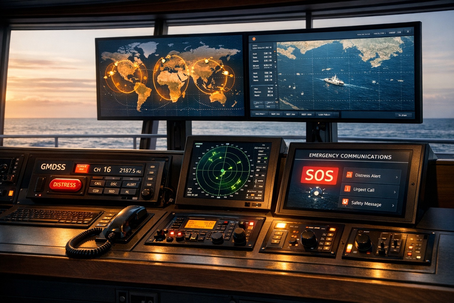
At the heart of GMDSS is Digital Selective Calling (DSC), a technology designed for automated distress alerting. Think of DSC as a "dial and bell" system that allows mariners to send distress alerts – including location and identification details – instantly to authorities and nearby ships without needing to monitor a radio loudspeaker constantly. Channel 70 (156.525 MHz) on VHF is exclusively reserved for DSC distress, safety, and calling purposes.

"Digital selective calling also allows mariners to initiate or receive distress, urgency, safety and routine radiotelephone calls… without requiring either party to be near a radio loudspeaker."

To include precise location data, DSC systems must be linked to GPS receivers using the NMEA 0183 protocol.

GMDSS regulations require all vessels under its scope to carry specific equipment, regardless of their operating area. This includes:

  • A 406 MHz Emergency Position Indicating Radio Beacon (EPIRB) for satellite-based distress alerts.
  • A NAVTEX receiver for automated maritime safety information.
  • A Search and Rescue Transponder (SART) to help locate survival craft.
  • Two-way portable VHF radios for on-scene communication.
  • A reserve power source to ensure radio functionality even if main and emergency power systems fail.

For satellite communications, IMO-recognized services currently include Inmarsat C, Fleet Safety, and Iridium Safety Services. The BeiDou Message Service System (BDMSS) is awaiting full implementation. The introduction of Iridium as a GMDSS provider ended Inmarsat’s monopoly and extended global coverage to include polar regions.

GMDSS regulations apply to cargo ships of 300 gross tons or more, as well as passenger ships carrying over 12 passengers on international voyages. These vessels must also have at least two licensed GMDSS radio operators, with one specifically assigned to handle communications during emergencies.

These systems and technologies are critical for ensuring reliable emergency communication, which remains a cornerstone of maritime safety.

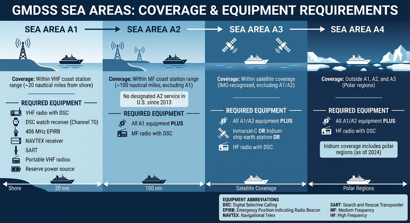
Sea Areas and Equipment Requirements

GMDSS divides the world’s oceans into four sea areas (A1 through A4), with equipment requirements tailored to the vessel’s operating area rather than its size.

  • Sea Area A1: Covers areas within VHF coast station range, typically up to 20 nautical miles from shore, where continuous DSC alerting is available. Since January 20, 2015, the U.S. Coast Guard has officially designated certain coastal regions as Sea Area A1. Vessels in this area must carry a VHF radiotelephone with DSC and a DSC watch receiver tuned to Channel 70.
  • Sea Area A2: Includes regions within medium frequency (MF) coast station range, usually up to 100 nautical miles from shore (excluding A1). However, with the U.S. Coast Guard discontinuing its 2 MHz infrastructure in 2013, there is no designated Sea Area A2 service in the United States. For U.S. vessels, leaving A1 effectively means entering Sea Area A3.
  • Sea Area A3: Encompasses areas covered by IMO-recognized mobile satellite services, such as Inmarsat or Iridium, excluding A1 and A2 zones. Vessels operating here need either an Inmarsat-C or Iridium ship earth station, or an HF radiotelephone with DSC, in addition to the equipment required for A1 and A2.
  • Sea Area A4: Covers polar regions and other areas beyond A1, A2, and A3. Ships in this zone must have an HF radiotelephone with DSC, along with the equipment required for A1 and A2. The inclusion of Iridium as a satellite provider has significantly improved coverage in these previously underserved areas.
Sea Area Definition Primary Equipment Required
A1 Within VHF coast station range (~20 nautical miles) VHF radio with DSC, DSC watch receiver (Channel 70)
A2 Within MF coast station range (~100 nautical miles, excluding A1) MF radio with DSC, plus A1 equipment
A3 Within satellite coverage (IMO-recognized, excluding A1/A2) Inmarsat‑C or Iridium ship earth station, or HF radio with DSC, plus A1/A2 equipment
A4 Outside A1, A2, and A3 (Polar regions) HF radio with DSC, plus A1/A2 equipment

Operators have three options for maintaining their equipment: shore-based maintenance, at-sea maintenance (requiring a licensed maintainer), or duplicating equipment. To avoid overloading the system, live testing of DSC distress and safety frequencies with coast stations should be limited to once per week.

Security and Reliability in GMDSS Operations

Regulations and Standards for GMDSS

The Global Maritime Distress and Safety System (GMDSS) operates under a framework of international and national regulations, including SOLAS Chapter IV, ITU Radio Regulations, and U.S. FCC 47 CFR Part 80. These guidelines ensure consistent and reliable performance. SOLAS Chapter IV is the cornerstone for ships on international voyages, while ITU Radio Regulations define the technical standards for maritime communication systems .

"The GMDSS is mandated for ships internationally by the International Maritime Organization (IMO) Safety of Life at Sea Convention (SOLAS), 1974, as amended, and carries the force of an international treaty."

To ensure compliance, FCC-licensed technicians and the U.S. Coast Guard conduct inspections, checking documentation, operator proficiency, and log records. Ships must carry essential documents such as the Cargo Ship Safety Radio Certificate (CSSRC), a Record of Equipment (Form R), and maintain radio logs for at least two years – or three years if related to distress incidents.

As of January 1, 2024, updated GMDSS regulations have taken effect, phasing out outdated requirements and paving the way for modern communication technologies.

Backup Systems and Reliability Features

GMDSS reliability hinges on a robust system of redundancies. Ships must be equipped to send distress alerts through at least two independent methods. Additionally, reserve power systems are mandatory, providing one hour of backup for vessels built after February 1, 1995, or six hours for older ships without specific emergency power setups.

In Sea Areas A3 and A4, vessels must implement two of three maintenance options: duplicate equipment, shore-based maintenance contracts, or at-sea maintenance capabilities. For Sea Areas A1 and A2, only one option is required. Digital Selective Calling (DSC) plays a critical role by automating distress alerts with preformatted digital messages, minimizing the risk of human error. Position accuracy is further ensured with automatic updates from GPS/GNSS receivers, or manual updates every four hours when necessary.

These layers of redundancy not only strengthen reliability but also enable seamless integration with advanced IT solutions.

How Advanced IT Solutions Support GMDSS

Modern IT solutions complement GMDSS by integrating it with onboard systems, enhancing both performance and reliability. Companies like NT Maritime offer secure communication platforms that link GMDSS equipment with other vessel systems. This integration allows for real-time monitoring of system health, automated position updates, and ensures backup systems are always operational.

For ships navigating global routes, particularly in remote Sea Areas A3 and A4, high-speed satellite connectivity from providers such as Inmarsat and Iridium is a game-changer. These satellite networks work in harmony with onboard systems, ensuring that critical components like VHF/HF radios, satellite earth stations, and backup systems operate as a unified whole. This level of integration is especially valuable during inspections, where crews must demonstrate compliance with SOLAS Chapter IV, including the functionality of reserve power and redundant equipment systems. By leveraging these advanced IT solutions, vessels can ensure seamless communication and operational readiness under all circumstances.

Installing and Managing GMDSS on Vessels

Selecting and Integrating GMDSS Equipment

Choosing the right GMDSS (Global Maritime Distress and Safety System) equipment depends on where your vessel operates. For vessels in Sea Area A1 – within VHF range of coastal stations – you’ll need a VHF with DSC (Digital Selective Calling), a 406 MHz EPIRB (Emergency Position Indicating Radio Beacon), NAVTEX, SART (Search and Rescue Transponder), and portable VHF radios. In Sea Area A2, add an MF (Medium Frequency) installation with DSC to this setup. For Sea Area A3, you’ll need either an MF/HF (High Frequency) installation or a mobile satellite service through providers like Inmarsat or Iridium. Vessels in Sea Area A4, which covers polar regions, must carry MF/HF equipment in addition to the A1 gear.

All GMDSS equipment must be FCC-certified, except for 406 MHz EPIRBs. Any DSC-capable devices must be programmed with your vessel’s unique nine-digit Maritime Mobile Service Identity (MMSI) number. To ensure accurate distress alerts, integrate communication equipment with a GPS receiver so that your vessel’s position is automatically included. If automatic integration isn’t an option, set up a strict manual protocol to update the position and time every four hours while underway.

Power systems are equally important. Vessels built after February 1, 1995, must have at least one hour of backup power, while older vessels require six hours. Maintenance strategies should align with approved plans tailored to your operating area.

Once the equipment is installed, training your crew on emergency operations is the next critical step.

Crew Training and Emergency Procedures

It’s mandatory for masters and mates to hold a GMDSS Radio Operator’s License, which involves completing a two-week training course and demonstrating proficiency with the equipment.

Crew training should include standardized distress protocols, such as DSC operations, satellite communication procedures, and the use of SAR (Search and Rescue) equipment like 406 MHz EPIRBs and SARTs. Additionally, they must know how to monitor Maritime Safety Information (MSI) using NAVTEX or SafetyNet systems.

To maintain operational readiness, equipment testing is vital. Crew members should conduct daily, weekly, and monthly checks, including battery voltage tests and DSC test calls. According to the U.S. Coast Guard, each vessel must have at least two licensed radio operators, with one designated as the primary operator:

"One of the operators shall be designated as the primary operator. But, they all must be capable of performing distress, urgency and safety communications."

Using NT Maritime Solutions for Emergency Communication

NT Maritime

Beyond hardware, NT Maritime offers advanced IT solutions to strengthen emergency communication. Their secure platforms integrate seamlessly with GMDSS equipment, providing real-time system health monitoring and ensuring that backup systems remain functional. During emergencies, Telehealth technologies enable vessels to connect with shore-based medical professionals through video calls and secure messaging, offering critical medical guidance when needed.

NT Maritime’s high-speed internet services also support data-heavy emergency coordination, ensuring smooth internal communication among crew members during crises. For government and military vessels, the company provides encrypted communication networks that meet federal standards, adding an extra layer of security for sensitive operations. These integrated systems work hand-in-hand with GMDSS equipment to keep crews informed and prepared in challenging situations.

Conclusion

The Global Maritime Distress and Safety System (GMDSS) has revolutionized maritime safety by creating a direct link between vessels and Rescue Coordination Centers. This system ensures that distress alerts are immediately relayed to authorities, enabling swift mobilization of rescue efforts and significantly reducing response times during emergencies. Thanks to Digital Selective Calling (DSC) technology, vessels can automatically transmit precise location and identification details – even in situations where crew members are unable to respond promptly.

The U.S. Coast Guard highlights the importance of GMDSS in maritime safety:

"GMDSS is a worldwide coordinated maritime distress system designed to provide the rapid transfer of distress messages from vessels in distress to units best suited for providing or coordinating assistance".

Recent advancements have further strengthened GMDSS capabilities. As of January 1, 2024, the system now integrates advanced satellite services alongside traditional Inmarsat technology, ensuring full global coverage – including the once-elusive polar regions. Whether navigating coastal waters within 20–30 miles of shore or venturing into remote polar seas, vessels can rely on dependable emergency communication.

In addition to these upgrades, NT Maritime has introduced innovative IT solutions to enhance maritime emergency communication. Their offerings include secure networks, real-time monitoring, and Telehealth services, which bolster GMDSS equipment. High-speed internet enables seamless coordination during emergencies, while encrypted networks provide an added layer of security for government and military vessels. Together, these advancements work hand in hand with GMDSS, creating a robust and reliable safety framework when lives are on the line.

To maintain this high level of safety, vessel operators must prioritize GMDSS compliance. This includes regular equipment testing, comprehensive crew training, and the integration of modern communication technologies to ensure the system functions flawlessly when it matters most.

FAQs

What equipment is required for vessels to comply with GMDSS regulations?

To comply with GMDSS requirements, vessels must have specific communication tools onboard to prioritize safety at sea. These tools include:

  • A VHF marine radio with Digital Selective Calling (DSC) for reliable short-range communication.
  • An MF/HF radiotelephone or satellite telephone for long-distance communication needs.
  • An Emergency Position Indicating Radio Beacon (EPIRB) to send distress signals and provide location data in emergencies.
  • A secondary VHF radio or cellular radio as a backup communication option.

This equipment is essential for sending and receiving distress alerts, coordinating search and rescue (SAR) operations, sharing maritime safety information, and ensuring seamless bridge-to-bridge communication. Proper installation and regular maintenance of these systems are crucial to meet regulatory standards and ensure safety at sea.

How does Iridium enhance GMDSS coverage?

Iridium’s network of low-Earth-orbit satellites offers worldwide coverage, even reaching remote and polar areas that were once hard to access. This expanded reach enables the GMDSS to deliver dependable distress communication from virtually anywhere on the planet, boosting maritime safety and improving emergency response efforts.

What certifications and training are required for crew members to operate GMDSS equipment?

To use GMDSS equipment, crew members need a U.S.-flag GMDSS Radio Operator endorsement along with the appropriate STCW endorsement. These certifications are granted after successfully completing a U.S. Coast Guard-approved training course and passing the necessary exam. This training ensures that operators are skilled in handling communication tools such as VHF and MF/HF radios, satellite EPIRBs, and NAVTEX systems.

The certification details are documented on the mariner’s STCW endorsement and must be kept current through periodic refresher courses to stay in line with Coast Guard regulations. NT Maritime offers customized training solutions to help vessels meet these regulatory requirements effectively.

High-Speed Internet for Military Ships: Key Providers

High-speed internet is critical for modern naval operations, ensuring communication, intelligence sharing, and crew welfare. Military ships require secure, reliable connectivity in remote and challenging environments. This article compares five key providers of maritime internet solutions for military use:

  • NT Maritime: Offers hybrid satellite systems (GEO, MEO, LEO) with global coverage, high speeds, and advanced security features tailored for defense needs.
  • Inmarsat Fleet Broadband: Reliable L-band GEO satellites with 99%+ uptime but limited to 80% global coverage and slower speeds (up to 432 kbps).
  • Iridium Certus: Provides 100% global coverage, including polar regions, with LEO satellites and moderate speeds (up to 704 kbps).
  • Viasat Government & Defense: High-throughput GEO satellites delivering multi-Mbps speeds, ideal for bandwidth-heavy tasks, but with higher latency and no polar coverage.
  • Starlink Business Maritime: LEO satellites offering 100–250 Mbps speeds and low latency (30–50 ms), with near-global coverage focused on major ocean regions.

Quick Comparison

Provider Coverage Speeds (Mbps) Latency Key Features
NT Maritime Global 10–100+ Mbps 20–600 ms Hybrid networks, tailored for defense, secure
Inmarsat Fleet 80% Global Up to 0.432 500–700 ms Reliable, all-weather, L-band GEO satellites
Iridium Certus 100% Global Up to 0.704 ~600 ms Pole-to-pole, durable solid-state antennas
Viasat Government Near-global Multi-Mbps ~600 ms High throughput, encrypted, defense-grade
Starlink Maritime Near-global 100–250 30–50 ms Low latency, cost-effective, data-heavy tasks

Military planners often combine L-band systems (e.g., Inmarsat, Iridium) for resilience with high-throughput options (e.g., Starlink, Viasat) for data-intensive activities. NT Maritime excels at integrating these networks into a single, secure platform to meet diverse naval mission needs.

Military Maritime Internet Providers Comparison: Speed, Coverage, and Latency

Military Maritime Internet Providers Comparison: Speed, Coverage, and Latency

1. NT Maritime High-Speed Internet Solutions

NT Maritime

Network Technology

NT Maritime delivers reliable connectivity through hybrid satellite architectures designed for uninterrupted operations. This system combines VSAT services over Ku/Ka-band frequencies with L-band backup links, leveraging networks like Inmarsat FleetBroadband and Iridium Certus. Its multi-path design automatically transitions between GEO, MEO, and LEO satellite constellations based on changing conditions. Onboard antennas work seamlessly with modems, routers, and firewalls, ensuring smooth segmentation of mission-critical and crew communications. The system supports VoIP, secure messaging, and video conferencing via a QoS-aware IP backbone, prioritizing low-latency traffic for essential command and control tasks. This advanced setup ensures dependable connectivity across maritime operations.

Coverage

Thanks to its hybrid design, NT Maritime provides consistent coverage across a variety of maritime environments. Its dual-network approach guarantees global connectivity, spanning equatorial to polar regions. This capability is vital for Arctic and Antarctic missions, where GEO satellites often have limited visibility. U.S. Navy vessels benefit from this system, maintaining connectivity in contested waters or during polar expeditions. Additionally, terrestrial links can be integrated when ships are near coastlines or in port, reducing dependency on satellite networks and expanding overall availability.

Security Features

NT Maritime’s networks are built to meet NIST 800-series cybersecurity standards and FIPS-validated cryptography requirements, ensuring secure operations for U.S. government and defense missions. All data is encrypted using IPsec and TLS-based VPNs, safeguarding critical command and control communications. The system includes next-generation firewalls with deep packet inspection, application-layer filtering, and geo-fencing for added protection. Logical segmentation through VLANs and role-based access controls separates mission networks, administrative systems, and crew welfare Wi-Fi. For Telehealth services, encryption is paired with data integrity checks and certificate-based authentication, protecting medical consultations and records while enabling secure remote specialist access during deployments.

Performance and Latency

NT Maritime’s satellite platforms deliver aggregate throughputs ranging from tens to hundreds of Mbps per vessel – an impressive leap from older systems that typically managed just 5–10 Mbps. Latency depends on the satellite orbit: GEO links generally experience round-trip delays of about 600 ms, suitable for tasks like email and file transfers, while LEO connections bring latency down to just tens of milliseconds, enhancing real-time operations. Traffic engineering further optimizes performance, prioritizing ISR feeds and command traffic with minimal jitter, while delaying bulk data transfers during critical operations. With reliability targets exceeding 99% link availability, automatic failover mechanisms ensure uninterrupted command and safety communications, even during harsh weather or satellite disruptions. These performance improvements are crucial for supporting mission-critical activities at sea.

2. Inmarsat Fleet Broadband Solutions

Inmarsat Fleet Broadband

Network Technology

Inmarsat FleetBroadband relies on L-band connectivity via GEO satellites to provide continuous IP data and voice services. Terminals like the SAILOR 250 and 500 allow users to handle data, email, and voice communications all at once. One key advantage of the L-band frequency is its resistance to rain fade, unlike higher-frequency bands like Ku or Ka. This makes it a dependable choice for mission-critical military operations, even in poor weather conditions. FleetBroadband is commonly integrated into military and government vessels, working alongside stabilized marine antennas and onboard routers to ensure seamless communication. This setup delivers reliable global coverage.

Coverage

FleetBroadband ensures consistent satellite internet access across roughly 80% of the globe, covering regions between 70°N and 70°S. This extensive reach is essential for military missions in varied maritime environments. However, polar regions remain outside its coverage, requiring alternative solutions for connectivity in those areas. The network boasts an impressive uptime reliability of over 99%, making it a trusted option for government and military operations where uninterrupted connectivity is critical.

Security Features

FleetBroadband is designed as a commercial platform that seamlessly integrates with secure government networks, rather than being a classified system on its own. To safeguard sensitive data, defense and homeland-security users implement end-to-end VPNs and IPsec tunnels that link ships to command centers. Encryption tools, such as FIPS-validated devices, are employed to protect critical traffic. Onboard, network segmentation separates operational, administrative, and crew networks, ensuring that only mission-specific systems can access secure shore connections. Additionally, FleetBroadband’s use of the L-band provides a reliable backup for essential communications, such as command and safety systems, when higher-capacity VSAT links are unavailable.

Performance and Latency

FleetBroadband terminals, like the SAILOR 500, support broadband speeds of up to 432 kbps and can handle up to nine simultaneous voice calls. This level of performance is ideal for tasks like email, web browsing, telemetry, and mission planning. However, it’s not equipped for high-bandwidth activities like HD video streaming. As a GEO-satellite service, FleetBroadband experiences latency ranging from 500 to 700 ms round-trip, which is higher than low-Earth-orbit systems. Despite this, the latency is manageable for voice communication, messaging, and many command-and-control applications. Military users often pair FleetBroadband with higher-throughput systems like VSAT or LEO for demanding tasks, using FleetBroadband as a dependable fallback when other networks falter.

3. Iridium Certus Maritime Platform

Iridium Certus

Network Technology

The Iridium Certus Maritime platform relies on a Low Earth Orbit (LEO) satellite network, with satellites positioned just 485 miles above the Earth. This setup ensures lower latency and stable signal quality. It operates using L-band frequencies, which are highly resistant to disruptions caused by rain or atmospheric conditions. The platform’s terminals deliver download speeds of over 700 kbps and upload speeds of 352 kbps, all through a single, integrated unit that supports voice, data, and safety services. Its solid-state antennas are maintenance-free and designed without moving parts, making them highly durable in tough maritime environments. This design significantly reduces the maintenance workload for military crews, even in the harshest conditions.

Coverage

Iridium Certus Maritime offers seamless global connectivity, providing 100% pole-to-pole coverage. This capability is especially valuable for naval operations in polar regions and remote oceanic areas where traditional satellite systems fall short. Whether it’s Arctic patrols, Antarctic research missions, or operations in international waters, military vessels can rely on uninterrupted communication. This ensures mission-critical tasks, real-time coordination with command centers onshore, and vital crew support services remain operational, no matter the location.

Security Features

The platform is built with military applications in mind, incorporating secure technology through equipment like the Thales VesseLINK Maritime terminal. While designed for commercial use, it employs military-grade encryption and advanced security protocols tailored for government and defense needs. The solid-state antennas and dedicated safety features provide reliable and secure communication without frequent maintenance, ensuring consistent performance even in high-stakes environments.

Performance and Latency

Iridium Certus Maritime terminals excel in supporting multiple high-quality voice lines, high-speed IP data, and safety services simultaneously. Thanks to its LEO satellite architecture, it achieves latency as low as 600 ms or less, enabling clear voice communication for command operations, fast data transfers for intelligence sharing, and dependable emergency protocols. The single-terminal design simplifies installation and operation on military vessels, reducing complexity while ensuring all communication needs are met. Additionally, built-in upgrade capabilities allow the platform to keep pace with evolving military communication demands, making it a future-ready solution.

4. Viasat Government & Defense Positioning

Network Technology

When it comes to high-speed maritime internet for defense, Viasat sets itself apart with its advanced HTS (High-Throughput Satellite) solutions. Using GEO satellites operating in the Ku- and Ka-bands with spot-beam architecture, Viasat delivers connectivity ranging from several Mbps to tens of Mbps. These services are designed to meet the needs of the U.S. Department of Defense, NATO, and allied naval operations. Viasat’s offerings go beyond just connectivity – they include the entire ecosystem: space segment, ground infrastructure, network management, terminals, and cybersecurity. This comprehensive approach ensures reliable and secure coverage for critical missions.

Coverage

Viasat provides near-global coverage, prioritizing key maritime operational zones. While its network reaches across most ocean areas, coverage in polar regions like the Arctic and Antarctic is limited. For these areas, additional SATCOM solutions are required to maintain connectivity.

Security Features

Security is a cornerstone of Viasat’s services. The company employs multiple layers of protection, including end-to-end encryption, IPsec protocols, and support for Type 1 cryptographic systems. Network monitoring and intrusion detection systems work alongside traffic segmentation to separate mission-critical data from administrative or crew-related traffic. Additionally, private government gateways ensure sensitive data stays off public networks. These measures align with FIPS and NSA Suite B standards, providing a high level of confidence for secure communications.

Performance and Latency

Using GEO satellites, Viasat operates with a round-trip latency of about 600 milliseconds. While this latency is inherent to GEO systems, it remains sufficient for command-and-control operations and real-time video feeds. Viasat’s infrastructure includes QoS (Quality of Service) protocols to ensure mission-critical data gets top priority. The "SATCOM as a Service" model also offers flexibility, allowing users to scale bandwidth as needed without requiring upfront capital investment.

Starlink Business Maritime

Network Technology

Starlink Maritime uses low Earth orbit (LEO) satellite technology to meet the intense demands of military operations at sea. Unlike traditional GEO satellites that orbit about 22,000 miles above Earth, Starlink’s LEO satellites operate much closer, which dramatically reduces latency. This low-latency setup is crucial for tasks like live ISR feeds, real-time mission planning, cloud-based command-and-control systems, and secure video conferencing – activities that often struggle with the delays of GEO networks. The system uses electronically steered flat-panel antennas, which are less bulky than traditional VSAT domes. This design not only simplifies deck installation but also minimizes radar cross-section concerns, all while delivering hundreds of Mbps per vessel.

Coverage

Starlink Maritime provides high-speed internet with near-global coverage, focusing on major shipping routes and ocean regions. For the U.S. Navy and Coast Guard, this means dependable connectivity across the Atlantic, Pacific, and Indian Oceans, as well as key chokepoints and coastal patrol areas. While LEO networks excel in most regions, they face challenges in extreme polar areas. To address this, military planners often combine LEO with GEO or L-band systems to ensure uninterrupted service for Arctic and high-latitude missions, where traditional providers still dominate. This hybrid approach ensures tactical operations benefit from both Starlink’s low-latency performance and broader coverage options.

Security Features

Starlink prioritizes security by incorporating encrypted user traffic and secure satellite-to-ground communications. For U.S. military and government use, Starlink is typically treated as a transport layer, with mission-critical encryption handled by tools like Type 1 or FIPS 140-validated VPNs, NSA-approved tactical radios, or secure tunneling gateways. To further enhance security, military users integrate Starlink terminals into shipboard systems that include firewalls, intrusion prevention measures, zero-trust identities, and cross-domain solutions. Many also use Starlink as part of a software-defined WAN (SD-WAN) setup, which dynamically routes sensitive traffic to more secure networks when necessary. This layered approach allows users to benefit from Starlink’s speed and low latency while adhering to strict DoD and intelligence community security standards.

Performance and Latency

Starlink Maritime delivers download speeds of 100–250 Mbps, upload speeds of 20 Mbps, and latency averaging 30–50 ms. This performance makes it possible to handle data-heavy tasks like HD video conferencing with shore-based teams, large software updates, intelligence transfers, and even concurrent crew internet use. The low latency is particularly useful for VoIP, real-time collaboration tools, and interactive training platforms, which have historically struggled on GEO networks. Pricing for Starlink Business Maritime is set at $250 per month, with hardware available for $1,999.

Provider Comparison: Advantages and Disadvantages

When it comes to selecting a high-speed internet provider for military ships, the decision hinges on several factors: network design, coverage, performance, and security. Each provider offers unique strengths and trade-offs, and understanding these is crucial to aligning capabilities with mission requirements.

NT Maritime (NT Connect) takes a unique approach as a systems integrator, blending multiple networks like Starlink, Inmarsat, and Iridium into a unified, managed solution. This setup ensures high throughput and built-in redundancy while offering tailored compliance for government and military fleets. However, its performance ultimately depends on the coverage and reliability of the underlying satellite networks.

Inmarsat Fleet Broadband is known for its reliability and all-weather performance, leveraging GEO L-band satellites to provide speeds up to 432 kbps with an impressive 99.9%+ uptime. While it delivers consistent voice and data capabilities essential for command operations, its coverage is limited to about 80% of the globe, falling short in extreme polar regions.

Iridium Certus stands out for its 100% global coverage, including pole-to-pole connectivity, thanks to its LEO L-band satellites. With speeds up to 704 kbps and robust solid-state antennas, it’s a solid choice for Arctic operations, backup links, and critical command communications where uninterrupted connectivity is vital.

Viasat Government & Defense offers high-capacity GEO Ka/Ku-band VSAT solutions, delivering multi-Mbps to tens of Mbps throughput. This makes it ideal for bandwidth-heavy tasks like real-time ISR feeds and HD video conferencing. Its strengths include integration with defense networks and secure, encrypted links. However, inherent GEO latency and limited coverage in extreme polar areas are considerations.

Starlink Business Maritime provides speeds between 100–250 Mbps with low latency (under 99 ms) using LEO Ku/Ka-band satellites. It offers a cost-effective option for high throughput compared to traditional GEO plans. While its coverage includes major shipping routes, it still requires verification for operations in extreme polar regions and long-term classified missions.

For military planners, the most effective approach often combines L-band systems (like Inmarsat or Iridium) for resilient command and safety communications with high-throughput options (like Starlink or Viasat) for mission-critical data and crew welfare. This layered network strategy, which integrates resilience, capacity, and security, is precisely what NT Maritime excels in delivering.

These comparisons highlight the importance of a multi-layered architecture to address the evolving demands of maritime missions effectively.

Conclusion

The best approach combines the unique strengths of different networks to meet specific mission requirements. Each provider brings distinct advantages that need to align with operational demands.

As outlined in the earlier provider reviews, the ideal solution hinges on matching network capabilities to mission needs. Some systems are built for global coverage, while others shine in uptime reliability or delivering high-capacity performance. High-throughput networks, for example, are excellent for handling bandwidth-heavy tasks in a cost-effective way.

A multi-layered strategy ensures seamless integration and security. NT Maritime offers a standout example by unifying multiple networks into a single, defense-grade platform designed to handle evolving military challenges.

For modern naval operations, a layered architecture is key. This means using L-band systems like Iridium or Inmarsat for mission-critical resilience, while relying on high-throughput networks like Viasat or Starlink for tasks requiring significant bandwidth. Integrated management becomes crucial for prioritizing traffic, maintaining security segmentation, and adapting to emerging threats. Smaller vessels with tighter budgets can focus on dependable L-band systems with basic data packages, while larger ships benefit from hybrid solutions that balance reliable access, crew welfare, and operational flexibility.

Military planners should adopt a tailored, modular approach. This involves combining resilient L-band links for essential tasks with high-capacity networks for data-intensive operations, ensuring the system can evolve alongside future mission requirements.

FAQs

What are the advantages of NT Maritime’s hybrid satellite system for military vessels?

NT Maritime’s hybrid satellite system delivers secure, high-speed internet access tailored for the unique demands of military operations at sea. This system ensures reliable communication networks that keep crews connected, even when operating in remote or challenging environments.

With this system, crews benefit from advanced onboard communication tools, including calling, messaging, and video conferencing. Additionally, its integrated systems are designed to enhance both operational efficiency and safety. These features are specifically crafted to meet military needs, enabling seamless communication and better coordination during critical missions.

How does NT Maritime provide secure communication for military ships?

NT Maritime specializes in providing secure communication systems specifically designed for military ships. By leveraging mission-critical networks and advanced location services, they ensure reliable and protected communication channels, even in the most demanding maritime conditions.

On top of that, NT Maritime integrates Telehealth technologies to address onboard medical needs, adding an extra layer of safety and operational efficiency for naval missions. Their solutions focus on delivering the security and reliability essential for government and military operations.

Why is a multi-layered network strategy essential for military maritime operations?

A robust, multi-layered network strategy plays a crucial role in military maritime operations. It ensures secure and reliable communication, even in the most remote or high-risk environments. By integrating various communication technologies – like onboard systems, satellite connections, and terrestrial networks – this approach creates redundancy, helping maintain uninterrupted connectivity.

Additionally, it bolsters cybersecurity by minimizing vulnerabilities and safeguarding mission-critical systems. This ensures that both strategic and tactical goals can be achieved effectively, no matter the conditions at sea.